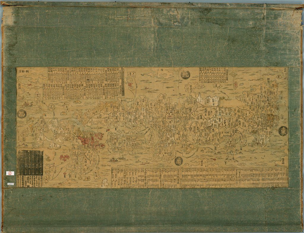
This picture map of Japan was published at the end of the 17th century. The cartographer, Ishikawa Tomonobu (also known as Ryūsen and Ryūshū) was an ukiyo-e artist and mapmaker. He is said to have been a student of Hishikawa Moronobu (1618–94), often considered the first ukiyo-e artist. It is the first map of Japan by Ryūsen with an imprint of his name. Said to be based on an original commissioned by the shogunate government, it was distorted and enlarged on the woodblock-printed sheet. The map served as both a travel guide and a directory of feudal lords. Written on it are the names of feudal lords and their wealth, as measured by the gross rice production of each fiefdom. Also indicated are post stations on highways such as the Tōkaidō, running from Edo (Tokyo) to Kyoto, the distances between stations, and popular venues. Thanks to its beautiful colors and wealth of information, Ryūsen’s map became very popular, and this style of map (called Ryūsen-zu) set the pattern for most published maps of Japan for the next century.
View Source© 2024 Pixel Fable. All rights reserved.