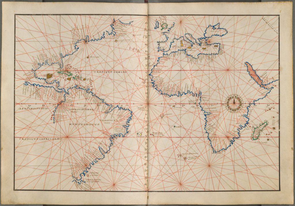
Battista Agnese (1514‒64) was a Venetian geographer and mapmaker. He produced at least 39 portolan, or maritime, atlases, ten of them signed and dated. All are distinguished by their neat calligraphy and are esteemed for their high quality and beauty. None was intended for use on board ship; they served as ceremonial gifts and as adornments to the libraries of the well-to-do. This atlas contains 20 pages of maps. The maps show the Pacific, Atlantic, and Indian Oceans, and the Baltic, Mediterranean, and Black Seas. Characteristic of all Agnese atlases are the routes of travels recorded on the map of the world. The Munich copy presented here shows, in blue, Magellan’s voyage from Lisbon, through the straits named after him, to the Moluccas, and the return voyage of the one surviving ship around the Cape of Good Hope (1519–22). A second line—faintly discernible, originally inscribed in silver—traces Pizarro’s voyage of 1521, which started from Cadiz, Spain, and crossed the Isthmus of Panama to reach the west coast of South America, thus inaugurating the Spanish conquest of Peru.
View Source© 2024 Pixel Fable. All rights reserved.