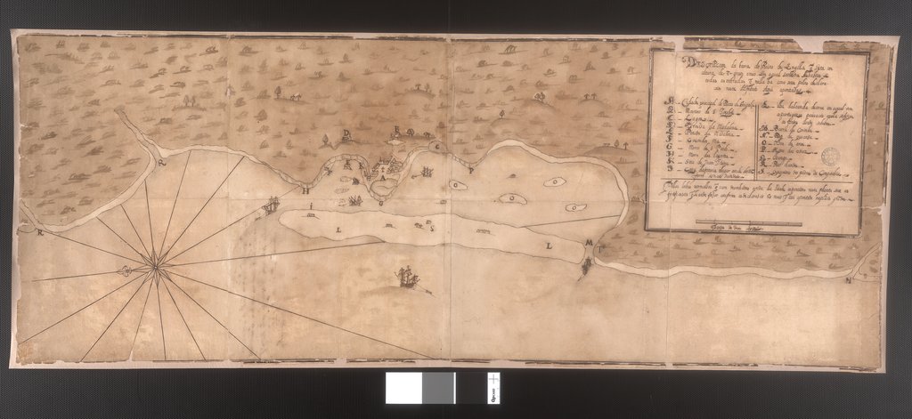
This map is an early depiction of the harbor and city of Luanda, on the coast of Angola. Founded by the Portuguese in 1575, The port of Luanda became the center of the Angolan slave trade, controlled by the Portuguese Empire, and which is estimated to have supplied around one-quarter of all African slaves sent to the Americas. Because of that, it also became the Portuguese administrative center in Angola in 1627, one year after this map was made.
View Source© 2026 Pixel Fable. All rights reserved.